
BestTachySpot
1K+
Downloads

Everyone
info


About this app
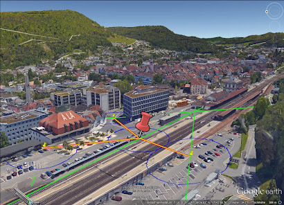
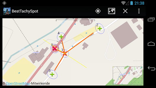
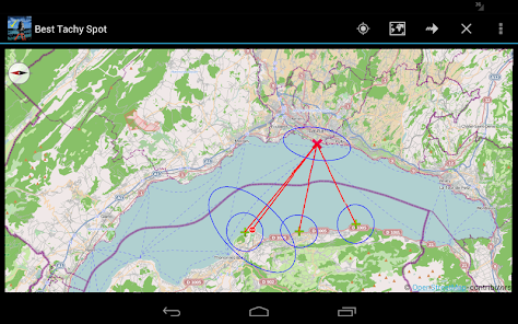
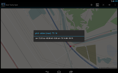
BestTachySpot analyses how the number and distribution of known points, i.e. points surveyed by total station, affects the accuracy of the Free Station. BestTachySpot is a planning and education tool.
Begin here with a Quick Start Guide
https://geomtours.blogspot.com.au/p/besttachyspot.html
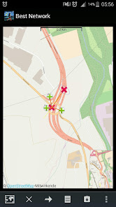
To perform pre-analyses of networks try BestNetwork
https://play.google.com/store/apps/details?id=bestnetwork.com.blogspot.geomtours
*** designed for ***
- surveyor
- Total Station user
Features:
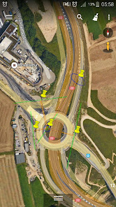
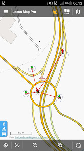
- Definition of instrument point on map
- Definition of target points
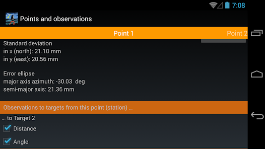
- Calculate accuracy with Least Squares Analysis
Settings:
- Definition of Standard deviation of known points
- Definition of Total Station Accuracy (distance and direction)
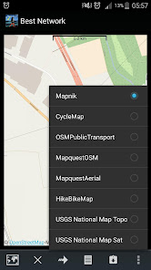
- Choose your background map (OpenstreetMap, USGS)
Keywords:
Surveying, Tachymeter, Total Station, Geomatics, Least Squares Analysis, Free Station, Resection, Precision, Pre-analysis, Simulation
Begin here with a Quick Start Guide
https://geomtours.blogspot.com.au/p/besttachyspot.html
To perform pre-analyses of networks try BestNetwork
https://play.google.com/store/apps/details?id=bestnetwork.com.blogspot.geomtours
*** designed for ***
- surveyor
- Total Station user
Features:
- Definition of instrument point on map
- Definition of target points
- Calculate accuracy with Least Squares Analysis
Settings:
- Definition of Standard deviation of known points
- Definition of Total Station Accuracy (distance and direction)
- Choose your background map (OpenstreetMap, USGS)
Keywords:
Surveying, Tachymeter, Total Station, Geomatics, Least Squares Analysis, Free Station, Resection, Precision, Pre-analysis, Simulation
Updated on
Data safety
Developers can show information here about how their app collects and uses your data. Learn more about data safety

No information available
What's new
New map