
Crisisworks
4.3star
6 reviews
1K+
Downloads

Everyone
info


About this app
THIS APP IS DESIGNED FOR THE CRISISWORKS 4 CLOUD SERVICE.
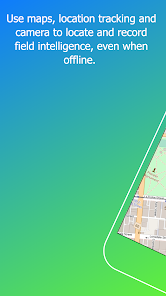
Capture intelligence and report on disaster impacts in real time using your iPhone or iPad.
Crisisworks provides a powerful way to conduct impact assessments and share data on the economic impact to property, infrastructure, environmental and social impacts.
Take photos, fill in purpose-built forms and draw the impact scene onto an online map, then easily and automatically transfer your impact assessments and reports to Crisisworks to share, organise, respond and recover.
Crisisworks can be used in the response and recovery phase of municipal emergencies, and also to log, manage and mitigate hazards during the planning phase.
Features:
* To use this app in production, you must be a valid Crisisworks user, otherwise you can use the "Try it out” feature.
* Secured to your Crisisworks account.
* A series of report templates match your workflow.
* Impact Assessments record the financial impacts across the four pillars of recovery.
* Property Assessments record residential and commercial property impacts, including affected and displaced people, services required and damage sustained.
* A map drawing tool allows for expressive geographic reporting.
* Take and attach photos of the scene to provide context and evidence.
* Synchronise your data back to a Crisisworks server automatically.
* Works even when no network coverage exists
Please note:
- To use this app, you must be a valid Crisisworks user.
- If you enable the Track Location feature, the GPS will run even if the app is in the background. Continued use of GPS running in the background can dramatically decrease battery life.
Updated on
Safety starts with understanding how developers collect and share your data. Data privacy and security practices may vary based on your use, region, and age. The developer provided this information and may update it over time.

No data shared with third parties
Learn more about how developers declare sharing

This app may collect these data types
Location, Personal info and 6 others

Data is encrypted in transit

Data can’t be deleted
Ratings and reviews
4.3
6 reviews

Peter Kakris
- Flag inappropriate
October 29, 2023
Great app for emergency management and compliance work It has a real offline mode and strong geospatial features as well Like selecting assets visually from a map tracking my route and auto drawing on the map as I drive
1 person found this review helpful

A Google user
- Flag inappropriate
February 26, 2017
Works great on samsung S7. Definitely need the larger screen size. Mobile function great for post impact assessments. Real time updates to desktop version
1 person found this review helpful
A Google user
- Flag inappropriate
June 13, 2016
I can not for the life of me tap the menu button using Samsung Galaxy 3. Icon way to small
What's new
- Fixed downloading offline assets
- Ensured background tracking is operable
- Ensured background tracking is operable