
Proyecto AVIS
100+
Downloads

Everyone
info

About this app
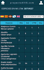
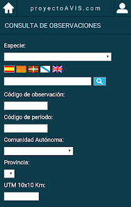
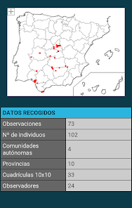
AVIS project is a collaborative basis of geolocation data from observations of birds in Spain which allows the exchange of information among ornithologists and amateur associations. The application allows mobile devices access to all information and can be done quickly and easily query the database, obtain distribution maps or add new observations to share with other users.
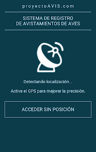
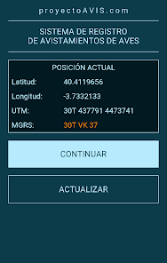
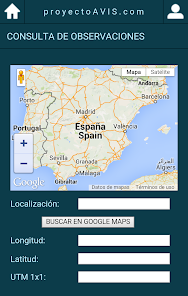
The observations are geographically located in 10x10 km grid, following the coordinate system UTM-MGRS. With the application we can get our current position in this format using the localization ability of our device or search the coordinates of any point via Google Maps.
All information in the database is also available on the website of proyectoAvis.com. Users familiar with the statistical environment 'R' ravis can also download the package that will incorporate the data into their analyzes.
The data offered by any available means are distributed under a Creative Commons license and can be used for any purpose fulfilling the requirement to recognize and cite the source of information.
Updated on
Safety starts with understanding how developers collect and share your data. Data privacy and security practices may vary based on your use, region, and age. The developer provided this information and may update it over time.

No data shared with third parties
Learn more about how developers declare sharing

This app may collect these data types
Location and Personal info

Data isn’t encrypted

You can request that data be deleted
What's new
V 1.2.4