

SityTrail hiking trail GPS
Contains adsIn-app purchases

3.8star
3.5K reviews
100K+
Downloads

Everyone
info


About this app
Go and discover all the paths around the world
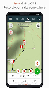
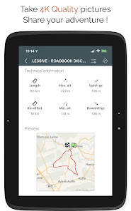
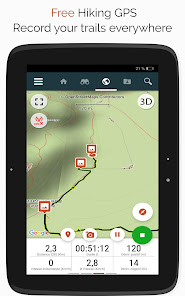
• Record your trails while taking HD and geo-tagged pictures of your adventures.
• Travelled distance, Km-effort, average speed, calories burned, etc.
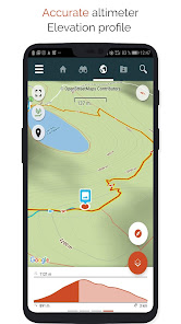
• Accurate altimeter, height differences computing and elevation profile displaying your current location.
• Alarm when you go off the path of the trail being followed. No more need to backtrack!
• Automatic triggering of points of interest with text-to-speech.
• Create a free account and all your data will be available everywhere on every device.
• Easy creation of trails and points of interest from our website.
• With our online editor, create your own trails using a Web browser on your PC/Mac and then access them directly from your smartphone to experience them on the ground.
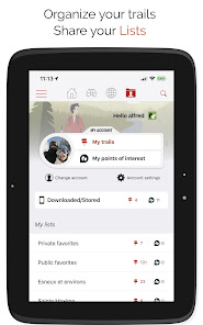
• Sort and classify your trails and points of interest in your own lists.
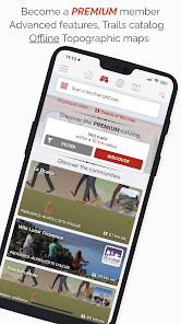
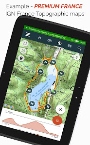
Go further and become a PREMIUM user!
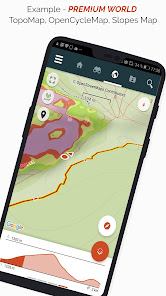
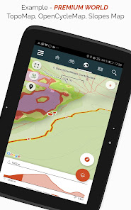
• Download world topographic maps for offline use.
• Discover GR hiking paths, European hiking routes, Santiago de Compostela routes for pilgrims, etc.
• Add topographic maps of your choice, from IGN France, IGN / NGI Belgium, IGN Spain, swisstopo, Austria, USA (USGS topographic mapping), Canada (Toporama).
• You can also discover all cycling networks: Greenway network in France, Ravel in Belgium, European cycling routes, knot points networks in Flanders and the Netherlands.
• And in winter, discover all the ski slopes with their names.
• Access the public catalogue of trails from SityTrail members and communities.
• Advanced tracking and guiding features with calculation of the remaining distance and time and vocal instructions at intersections.
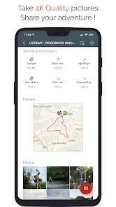
• Go further and transform your favourite trails into real multimedia guides with text, photos, video links, and share them with the SityTrail community.
• Create your own hiker communities and manage your members and newsfeeds.
• Create trails with our advanced features for trail editing via our website.
• Print trails in PDF format with QR codes. (A4, A3).
• Access geotagged Wikipedia articles from our SityTrip module.
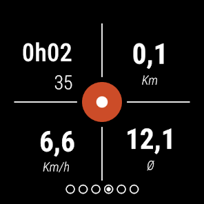
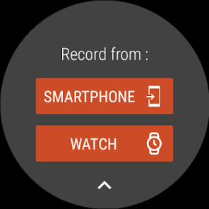
Record a trail on your Wear OS watch
You can record a trail on your Wear OS watch in standalone mode (not connected to an Android smartphone) or in paired mode (connected to an Android smartphone).
The application also allows logging in to your existing SityTrail account (from the screen which is the most on the left) when the watch is used in standalone mode.
Important Information
• Some features need an internet connection.
• The prolonged use of GPS can reduce battery levels.
• Record your trails while taking HD and geo-tagged pictures of your adventures.
• Travelled distance, Km-effort, average speed, calories burned, etc.
• Accurate altimeter, height differences computing and elevation profile displaying your current location.
• Alarm when you go off the path of the trail being followed. No more need to backtrack!
• Automatic triggering of points of interest with text-to-speech.
• Create a free account and all your data will be available everywhere on every device.
• Easy creation of trails and points of interest from our website.
• With our online editor, create your own trails using a Web browser on your PC/Mac and then access them directly from your smartphone to experience them on the ground.
• Sort and classify your trails and points of interest in your own lists.
Go further and become a PREMIUM user!
• Download world topographic maps for offline use.
• Discover GR hiking paths, European hiking routes, Santiago de Compostela routes for pilgrims, etc.
• Add topographic maps of your choice, from IGN France, IGN / NGI Belgium, IGN Spain, swisstopo, Austria, USA (USGS topographic mapping), Canada (Toporama).
• You can also discover all cycling networks: Greenway network in France, Ravel in Belgium, European cycling routes, knot points networks in Flanders and the Netherlands.
• And in winter, discover all the ski slopes with their names.
• Access the public catalogue of trails from SityTrail members and communities.
• Advanced tracking and guiding features with calculation of the remaining distance and time and vocal instructions at intersections.
• Go further and transform your favourite trails into real multimedia guides with text, photos, video links, and share them with the SityTrail community.
• Create your own hiker communities and manage your members and newsfeeds.
• Create trails with our advanced features for trail editing via our website.
• Print trails in PDF format with QR codes. (A4, A3).
• Access geotagged Wikipedia articles from our SityTrip module.
Record a trail on your Wear OS watch
You can record a trail on your Wear OS watch in standalone mode (not connected to an Android smartphone) or in paired mode (connected to an Android smartphone).
The application also allows logging in to your existing SityTrail account (from the screen which is the most on the left) when the watch is used in standalone mode.
Important Information
• Some features need an internet connection.
• The prolonged use of GPS can reduce battery levels.
Updated on
Safety starts with understanding how developers collect and share your data. Data privacy and security practices may vary based on your use, region, and age. The developer provided this information and may update it over time.


Ratings and reviews
4.0
3.26K reviews

Byron Hawkins
- Flag inappropriate
July 13, 2022
Works ok, but the user interface is confusing. I'm never sure when it's downloading something, or opening it for navigation, or recording my route, or whatever. It could be tremendously improved with a very small amount of logical thinking. For 25 € per year, absolutely not. Uninstalled.
Geolives Belgium S.P.R.L.
July 18, 2022
Hello. Can you please contact us via the "Help and support" page on https://www.sitytrail.com or the e-mail address help@geolives.com? Thank you. Best regards.

Geert H.
- Flag inappropriate
November 21, 2023
I use this app quiet often to track dowloaded routes or even plan my walks before I start. Works great in tracking and adding photos on the track. Only negative point for the moment is the saving of your recorded track when you finish. If the track is long or contains photo's the saving is very slow... Seems like it wants to send it directly to the cloud. It even happens this process hangs and you lose the entire track. Should be better to save it locally first and try to upload at a later time.
1 person found this review helpful
Geolives Belgium S.P.R.L.
November 22, 2023
Hello. Thanks for your feedback. If there is no connection or a bad quality connection, even if the process of sending the trails and the photos fails, the application tries again to send it when it is launched again with a working Internet connection. If you encounter problems, don't hesitate to contact us via help@geolives.com or our help page.

Bruno Milliard
- Flag inappropriate
August 15, 2020
I have been happily using the app for many years, but the current version is terrible. Not intuitive, no gpx export, no interesting plots. We are back to the level of the worst hiking apps in the previous century. No clear incidents, has just become useless. May be some new/promised gadgets like hotel reservation are of interest for some users. I need an app to actually hike.
1 person found this review helpful
Geolives Belgium S.P.R.L.
August 17, 2020
Hello. Can you please contact us via the "Help and support" page on https://www.sitytrail.com or via help@geolives.com ? Thank you. Best regards.
What's new
- Compliance with new EU GDPR regulations
- Minor bug fixes
- Minor bug fixes