National Public Toilet Map
10K+
Downloads

Everyone
info
About this app
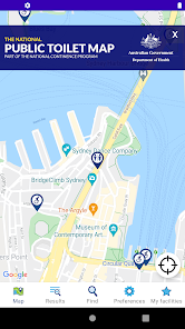
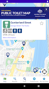
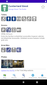
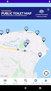
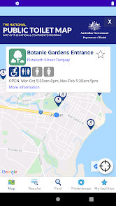
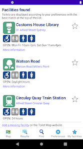
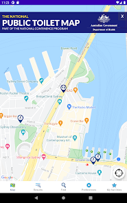
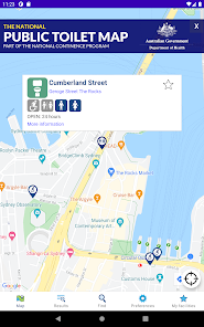
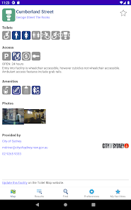
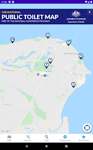
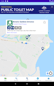
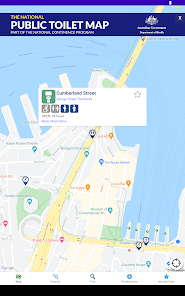
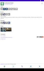
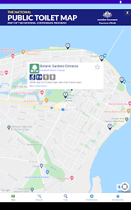
The free official National Public Toilet Map app from the Australian Government Department of Health and Aged Care shows the location of more than 23,000 publicly available toilets in Australia and includes details of accessibility, opening hours and other features such as sharps disposal and baby change.
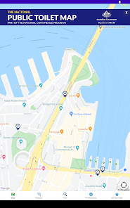
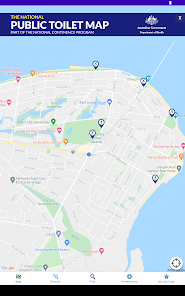
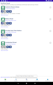
• Find nearby toilets or search for a place you will be visiting.
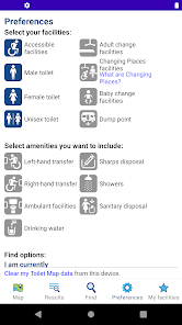
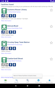
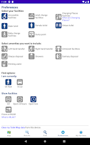
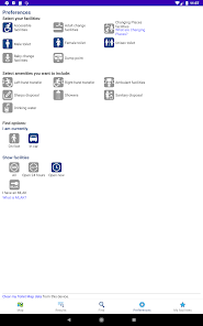
• Personalise your results by setting your preferences to return toilets that meet your needs, e.g ambulant, accessible parking, right or left hand transfer.
• See the locations on the map and/or view the toilets in the list to see details and get directions - on foot or in a car.
The National Public Toilet Map is funded by the Australian Government Department of Health as part of the National Continence Program to assist the estimated 4.8 million Australians affected by continence issues.
• Find nearby toilets or search for a place you will be visiting.
• Personalise your results by setting your preferences to return toilets that meet your needs, e.g ambulant, accessible parking, right or left hand transfer.
• See the locations on the map and/or view the toilets in the list to see details and get directions - on foot or in a car.
The National Public Toilet Map is funded by the Australian Government Department of Health as part of the National Continence Program to assist the estimated 4.8 million Australians affected by continence issues.
Updated on
Safety starts with understanding how developers collect and share your data. Data privacy and security practices may vary based on your use, region, and age. The developer provided this information and may update it over time.

No data shared with third parties
Learn more about how developers declare sharing

This app may collect these data types
Personal info, Photos and videos, and App activity

Data is encrypted in transit

You can request that data be deleted
What's new
Minor fixes and improvements.