
iGRID
Contains ads
4.7star
14 reviews
1K+
Downloads

Everyone
info
About this app
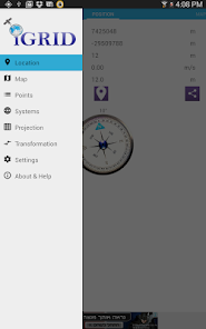
• iGRID is a powerful tool that enables you to see, add, edit and share locations and coordinate systems.
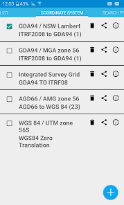
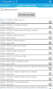
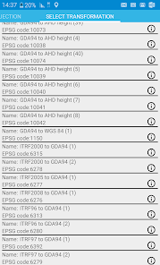
• Set up your coordinate system, choosing from the most up to date projection and transformation
systems from EPSG online registry or manually add your own for FREE.
• Share coordinate systems with friends and co-workers.
• Share your location with navigation apps on your device or share points with full description (image, coordinates, coordinate system, and time) as simple text.
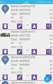
• Manage your lists of points and systems by Creating, editing, sharing and deleting.
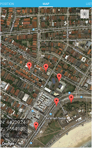
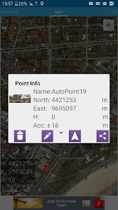
• See your points as markers in google map and add location by tapping on the map. See detailed point information on the map by tapping on it.
• See distance, geographical distance (geodesic) or 3d distance and azimuth from your location to the selected marker on the map.
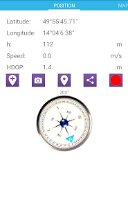
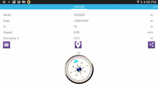
• See your current location, accuracy and ground speed from the GNSS sensor and bearing with built in compass based on the magnetic sensor.
• Add a default name to save your points name automatically.
• Import and export list of points
• Record your location with time or distance intervals and accuracy and PDOP limits
• Set up your coordinate system, choosing from the most up to date projection and transformation
systems from EPSG online registry or manually add your own for FREE.
• Share coordinate systems with friends and co-workers.
• Share your location with navigation apps on your device or share points with full description (image, coordinates, coordinate system, and time) as simple text.
• Manage your lists of points and systems by Creating, editing, sharing and deleting.
• See your points as markers in google map and add location by tapping on the map. See detailed point information on the map by tapping on it.
• See distance, geographical distance (geodesic) or 3d distance and azimuth from your location to the selected marker on the map.
• See your current location, accuracy and ground speed from the GNSS sensor and bearing with built in compass based on the magnetic sensor.
• Add a default name to save your points name automatically.
• Import and export list of points
• Record your location with time or distance intervals and accuracy and PDOP limits
Updated on
Data safety
Developers can show information here about how their app collects and uses your data. Learn more about data safety

No information available
Ratings and reviews
4.7
14 reviews

A Google user
- Flag inappropriate
March 6, 2016
Amazing application. Must have for any surveyor!
3 people found this review helpful
A Google user
- Flag inappropriate
April 5, 2017
Awesome app!
1 person found this review helpful
What's new
Fixed some bugs