
WATisRain
4.5star
104 reviews
5K+
Downloads

Everyone
info
About this app
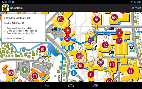
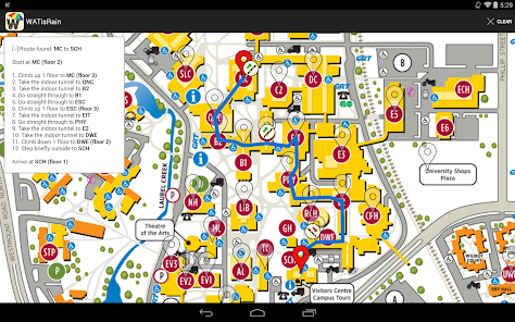
WATisRain is an Android app to help you navigate the buildings of the University of Waterloo without going outside (ie, by going through the various tunnels between buildings). This may prove to be useful when it's raining outside, or if it's freezing cold.
Features
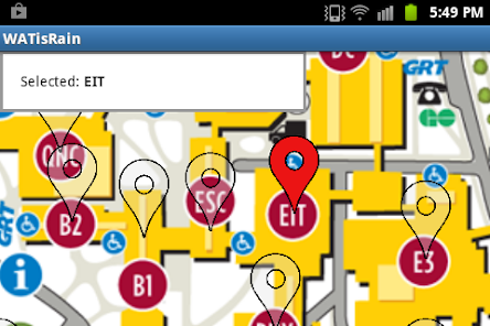
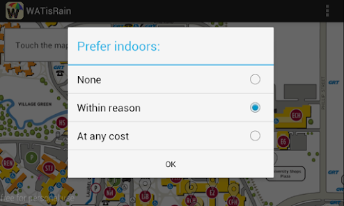
* Easy to use graphical interface
* Supports all bridges and tunnels, and most major buildings on campus
* Direction list as well as route displayed on map
* Tells you when to climb up and down stairs
* 100% open source and ad free
GitHub: https://github.com/luckytoilet/WATisRain
Features
* Easy to use graphical interface
* Supports all bridges and tunnels, and most major buildings on campus
* Direction list as well as route displayed on map
* Tells you when to climb up and down stairs
* 100% open source and ad free
GitHub: https://github.com/luckytoilet/WATisRain
Updated on
Safety starts with understanding how developers collect and share your data. Data privacy and security practices may vary based on your use, region, and age. The developer provided this information and may update it over time.

No data shared with third parties
Learn more about how developers declare sharing

No data collected
Learn more about how developers declare collection
Ratings and reviews
4.5
102 reviews

A Google user
- Flag inappropriate
- Show review history
November 26, 2018
The app is awesome for Android phones. I love whoever made this!
4 people found this review helpful
A Google user
- Flag inappropriate
March 11, 2020
Should show all possible paths so people don't get lost in EIT
A Google user
- Flag inappropriate
February 25, 2018
It's pretty nice could use some UI/UX changes. The image for stairs up/down needs to be more apparent and maybe not circle as it's hard to notice in the clutured UW map. Adding "covered walk ways okay" option like the one between MC and QNC or QNC and B2 is good. Could also benefit from more buildings (I get most of the others you're SOL for staying inside). Finally, viewing it on Google maps in stead of Waterloo maps would be cool
4 people found this review helpful
What's new
Update map with STC building