
Tactileo Map
4.1star
14 reviews
1K+
Downloads

Everyone
info
About this app
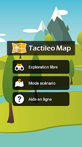
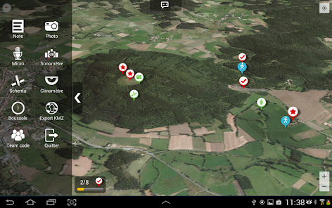
Tactileo Map is a GIS application for the support of students in field output, which offers two modes of operation:
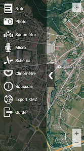
- Mode "free exploration" allows students to collect geo-referenced data (notes, photos, audio, diagrams ...)
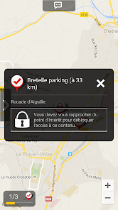
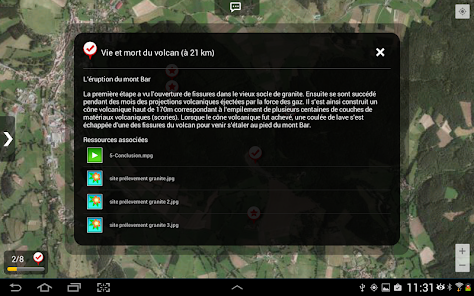
- The mode "Scenario" allows students to upload a scenario put to them by their teacher. The script contains points of interest, and educational resources for students to unlock during their field trip.
WARNING: Creating scenarios requires an account on the platform Tactileo (http://www.tactileo.com).
- Mode "free exploration" allows students to collect geo-referenced data (notes, photos, audio, diagrams ...)
- The mode "Scenario" allows students to upload a scenario put to them by their teacher. The script contains points of interest, and educational resources for students to unlock during their field trip.
WARNING: Creating scenarios requires an account on the platform Tactileo (http://www.tactileo.com).
Updated on
Data safety
Developers can show information here about how their app collects and uses your data. Learn more about data safety

No information available
Ratings and reviews
4.1
14 reviews
What's new
- Anonymous session grants access to every scenario saved in device to allow their use offline
- Downloading maps with QR code for offline use is back for anonymous users
- Free sessions are available for connected users to save media in their Tactileo accounts
- Bug fixes: Crashes at resource saving. Crashes when Geoloc infos can't be fetched
- Downloading maps with QR code for offline use is back for anonymous users
- Free sessions are available for connected users to save media in their Tactileo accounts
- Bug fixes: Crashes at resource saving. Crashes when Geoloc infos can't be fetched