
Mapas de España
4.5star
2.63K reviews
500K+
Downloads

Everyone
info


About this app
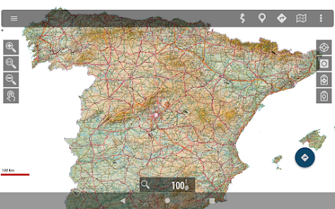
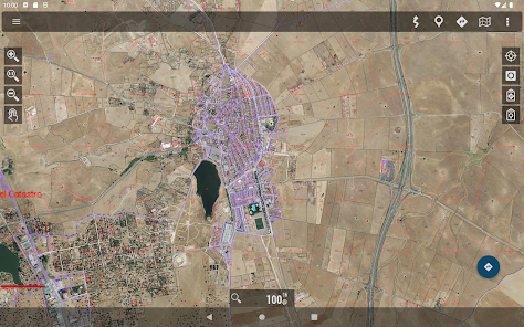
Free viewer ideal for hiking, cycling, running or skiing, which uses as background cartography the services of the National Geographic Institute and another set of services from other Ministries, such as the Cadastral information of the plots provided by the General Directorate of Cadastre.
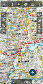
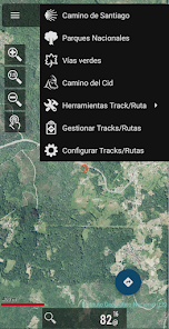
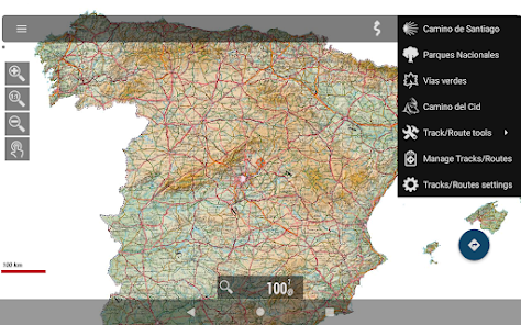
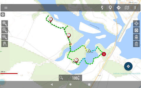
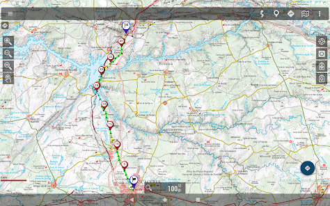
With this application you can travel the routes of the National Parks or the stages of the Camino de Santiago or use your TRACKS/ROUTES, plan excursions using maps, navigation and guided tours, without having to have an internet connection.
All maps and routes used are free and allow you to:
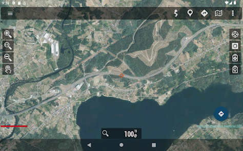
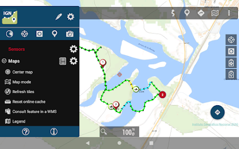
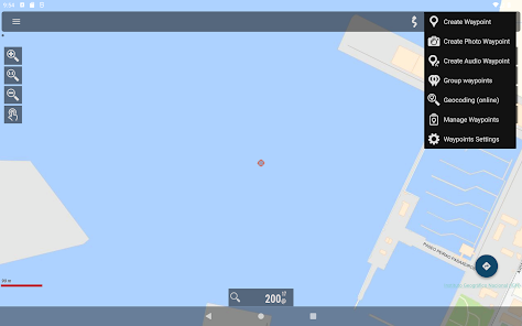
- GPS location, even without mobile coverage
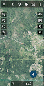
- Offline map mode*: save them in advance
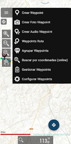
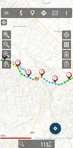
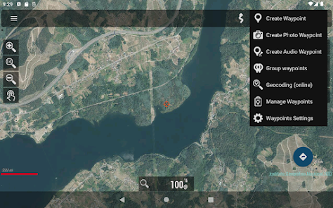
- Trace routes (Tracks) with GPS on the maps of the National Geographic Institute.
- Save and view tracks in gpx or kml and kmz format.
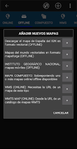
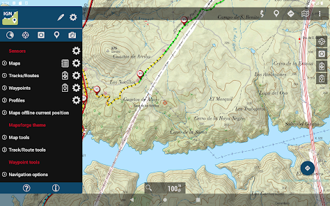
- Supports IGN's WMS and WMTS map services, you can use the application as a WMS viewer
- Use the services of the CartoCiudad project to locate places
- Positioning visualization using coordinates, heading, speed, altitude. Distance calculation
- The application is available in Spanish, Catalan, Galician, Basque and English.
- Based on OruxMaps software.
Maps of Spain is used as a GIS tool, comes from a Spanish government department (https://www.ign.es/web/ign/portal) and is used by professionals of various types, including workers of the Spanish State (police, forest guards, firefighters...)
It is common to have the catalog of maps of Spain in internal storage. For example, databases, in mbtiles format:
https://centrodedescargas.cnig.es/CentroDescargas/loadMapMov.do
It is not possible to move all that information to the private storage of each app that wants to use that data (we are talking about tens or hundreds of gigabytes). And from public storage, using the Android file access system, direct and random access to files is not allowed, which is required by the app to access databases or binary map formats.
Without this permission, professional and non-professional users who regularly use the app as a GIS will not be able to continue using the app as needed.
Identification Number of Official Publications (NIPO): 162190330
With this application you can travel the routes of the National Parks or the stages of the Camino de Santiago or use your TRACKS/ROUTES, plan excursions using maps, navigation and guided tours, without having to have an internet connection.
All maps and routes used are free and allow you to:
- GPS location, even without mobile coverage
- Offline map mode*: save them in advance
- Trace routes (Tracks) with GPS on the maps of the National Geographic Institute.
- Save and view tracks in gpx or kml and kmz format.
- Supports IGN's WMS and WMTS map services, you can use the application as a WMS viewer
- Use the services of the CartoCiudad project to locate places
- Positioning visualization using coordinates, heading, speed, altitude. Distance calculation
- The application is available in Spanish, Catalan, Galician, Basque and English.
- Based on OruxMaps software.
Maps of Spain is used as a GIS tool, comes from a Spanish government department (https://www.ign.es/web/ign/portal) and is used by professionals of various types, including workers of the Spanish State (police, forest guards, firefighters...)
It is common to have the catalog of maps of Spain in internal storage. For example, databases, in mbtiles format:
https://centrodedescargas.cnig.es/CentroDescargas/loadMapMov.do
It is not possible to move all that information to the private storage of each app that wants to use that data (we are talking about tens or hundreds of gigabytes). And from public storage, using the Android file access system, direct and random access to files is not allowed, which is required by the app to access databases or binary map formats.
Without this permission, professional and non-professional users who regularly use the app as a GIS will not be able to continue using the app as needed.
Identification Number of Official Publications (NIPO): 162190330
Updated on
Safety starts with understanding how developers collect and share your data. Data privacy and security practices may vary based on your use, region, and age. The developer provided this information and may update it over time.

No data shared with third parties
Learn more about how developers declare sharing

No data collected
Learn more about how developers declare collection

Data isn’t encrypted
Data can’t be deleted
Ratings and reviews
4.5
2.43K reviews

ja ar
- Flag inappropriate
- Show review history
March 2, 2023
It is a fantastic app. I am a profound user for few years now. Overall excellent! I would really appreciate if you could fix a bug in the tablet (ipad) version. I used to import the tracks I create in the smartphone to the ipad and work them there, but last year the import feature stop working. Thank you very much ***Efectivamente, me refiero a MEB que tengo en el ipad. Esta funcionalidad iba bien pero desde el año pasado ya no. La usaba para importar los tracks que hago y trabajarlos. Gracias.
Centro Nacional de Información Geográfica - CNIG
March 7, 2023
Gracias por su comentario. ¿Nos puedes enviar información del problema y un ejemplo de una ruta que no importa bien a consulta@cnig.es? Al igual que en esta app, hemos actualizado hace menos de un mes a una nueva versión.

A Google user
- Flag inappropriate
- Show review history
August 16, 2019
Very good GPS app. Usefull, consistent and reliable. No need improved accuracy web assistant. Wide range of parameters. Customizable information display. PDF manual in site. Automatically path upload if wanted. I've using it for 6 years. Muy buena aplicación de GPS. Útil, estable y confiable. No es necesario el asistente web de precisión. Amplia gama de parámetros. Visualización de info personalizable. Manual PDF en la web. Ruta de carga automática si se desea. La uso hace 6 años.
2 people found this review helpful
Centro Nacional de Información Geográfica - CNIG
August 27, 2019
Muchas gracias por tu comentario.

Thomas Amos
- Flag inappropriate
April 11, 2023
Excellent application. Finding decent maps in Spain was difficult, but this is as close to Ordnance Survey as you can get. Now if only I could buy the paper ones somewhere.. anywhere?
Centro Nacional de Información Geográfica - CNIG
April 17, 2023
Gracias por su comentario. Tenemos Tienda virtual, y los puntos físicos de venta en diferentes ciudades de España están en https://www.cnig.es/puntosVenta
What's new
Permiso de acceso a todos los ficheros. Si se acepta, la app trabaja como las versiones antiguas, con las carpetas en la raíz del almacenamiento interno.
Nuevas rutas con posibilidad de descarga directa desde la app dentro de la nueva sección Rutas, ocio y tiempo libre: Senderos FEDME, Rutas Culturales de España, Rutas IMBA, Caminos Naturales.
Cambios interfaz.
Nuevo tema Material de Google.
Conexión con SICAMI.
Todos las actualizaciones disponibles en la sección Control de Cambios.


