Powder Project
4.2star
51 reviews
10K+
Downloads

Everyone
info


About this app
Powder Project is your comprehensive guide to the best ski lines, wherever you are.
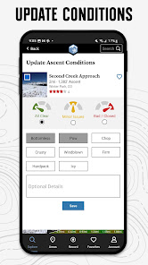
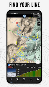
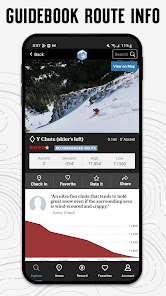
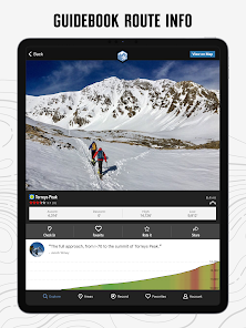
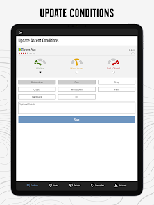
With the thoroughness of a printed map, we offer full GPS route info, elevation profiles, interactive features, photos, and more. Like a guidebook, we suggest the best featured ski lines to explore—either near your current location or in an area you search for. Local experts show you the highlights, challenging features, and insights you need to plan a great day in the snow.
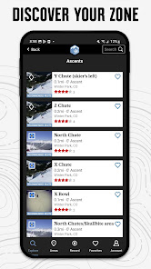
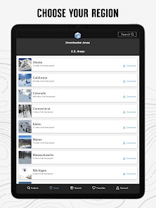
• Find over 800 miles of backcountry, sidecountry, and secret stashes.
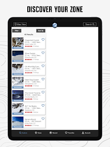
• New lines are constantly added to our incredibly detailed ski ascent and descent trail database.
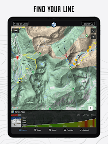
• Your exact location is shown on the trail.
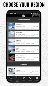
• Downloaded trails work offline for when you’re off the grid. (No cell reception required!)
• Enjoy high-resolution photos and detailed topographical trail maps.
• We’ll sync with your to-do list and check-ins on PowderProject.com.
Continued use of GPS running in the background can dramatically decrease battery life.
Links:
• Privacy Policy: https://www.adventureprojects.net/ap-privacy
• Terms of Service: https://www.adventureprojects.net/ap-terms
With the thoroughness of a printed map, we offer full GPS route info, elevation profiles, interactive features, photos, and more. Like a guidebook, we suggest the best featured ski lines to explore—either near your current location or in an area you search for. Local experts show you the highlights, challenging features, and insights you need to plan a great day in the snow.
• Find over 800 miles of backcountry, sidecountry, and secret stashes.
• New lines are constantly added to our incredibly detailed ski ascent and descent trail database.
• Your exact location is shown on the trail.
• Downloaded trails work offline for when you’re off the grid. (No cell reception required!)
• Enjoy high-resolution photos and detailed topographical trail maps.
• We’ll sync with your to-do list and check-ins on PowderProject.com.
Continued use of GPS running in the background can dramatically decrease battery life.
Links:
• Privacy Policy: https://www.adventureprojects.net/ap-privacy
• Terms of Service: https://www.adventureprojects.net/ap-terms
Updated on
Safety starts with understanding how developers collect and share your data. Data privacy and security practices may vary based on your use, region, and age. The developer provided this information and may update it over time.

No data shared with third parties
Learn more about how developers declare sharing

This app may collect these data types
Personal info, App activity and 2 others

Data is encrypted in transit

You can request that data be deleted
Ratings and reviews
4.2
51 reviews

Mark Gehrke
- Flag inappropriate
June 1, 2022
Powder projects would be useful if it had the degrees of slope overlay to let users know if terrain was over 30 degrees slope. The grade of the path on the profile is shown in percent on the app. Avalanche data is typically shown in degrees. Could show both degrees and (percent). But what is more important is the degree of the slope of the terrain that is around your planned tour/ lines. It would be great if you could see the slope data of the terrain, draw in a planned accent in safe terrain.
3 people found this review helpful

Gerald Murphy
- Flag inappropriate
February 1, 2023
It would be very useful if there was a way to turn on slope angle shading (to better view avy terain). It's not quite as useful as Mountain Project or Hiking Project since there are still pretty limited routes. Hopefully a lot more get added in the future.
2 people found this review helpful

Trent C Allen (TBone)
- Flag inappropriate
June 17, 2022
Every few months I come back to check this young app and each time it get better with more tracks. Very basic easy to understand the tools on app and each season that comes by this app will be one of the best Backcountry ski line apps.
4 people found this review helpful
What's new
- Bugfixes


