
BayernInfo Maps
4.0star
662 reviews
100K+
Downloads

Everyone
info


About this app
BAYERNINFO MAPS offers "route planning for cars" and "travel information for bus & train" in one app - and all for free!
Surprises along the way are becoming rarer. Knowing construction sites, closures and delays in advance means less stress and lower travel costs. And if something unforeseen happens on the way, you always have alternative route recommendations at hand.
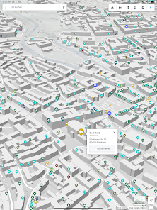
BAYERNINFO MAPS provides the most important information for planning your trip:
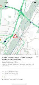
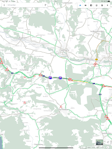
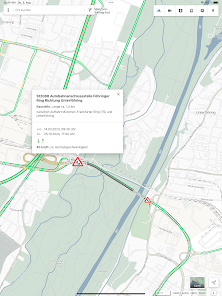
- Current traffic situation with all known construction sites, closures and traffic reports for all of Bavaria
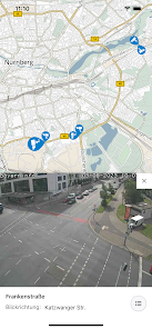
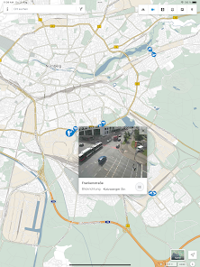
- Images from around 500 traffic cameras along the motorways, federal and state roads in Bavaria and neighboring regions (due to current developments in Europe, the images from the traffic cameras are only available to a limited extent until further notice)
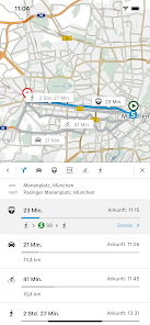
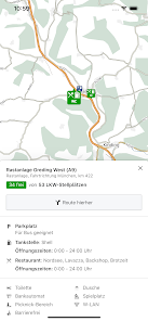
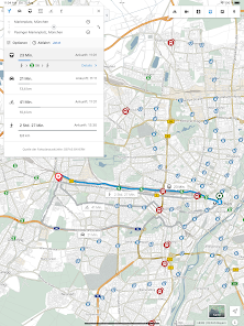
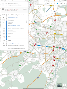
- Intermodal route planning for cars, buses and trains, on request also for Park & Ride, bicycles and pedestrians
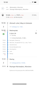
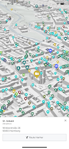
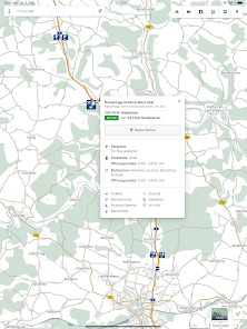
- Stops and POIs - Current departure times and delays in public transport
- Construction site calendar for the phone version
- Route overview: current delay times on selected routes at a glance
Finally, a brief explanation of the purposes for which the app requires certain permissions:
- Precise location (GPS): Necessary to display your own position and for routing from / to your own location
- Full internet access: Required to access the server-side services (map, location and route search)
- Access to protected memory: Necessary for caching (intermediate storage) of map data
Services from the BayernInfo project were co-financed by the European Union.
BAYERNINFO MAPS - mobile information - relaxed on the way - arrive safely
Surprises along the way are becoming rarer. Knowing construction sites, closures and delays in advance means less stress and lower travel costs. And if something unforeseen happens on the way, you always have alternative route recommendations at hand.
BAYERNINFO MAPS provides the most important information for planning your trip:
- Current traffic situation with all known construction sites, closures and traffic reports for all of Bavaria
- Images from around 500 traffic cameras along the motorways, federal and state roads in Bavaria and neighboring regions (due to current developments in Europe, the images from the traffic cameras are only available to a limited extent until further notice)
- Intermodal route planning for cars, buses and trains, on request also for Park & Ride, bicycles and pedestrians
- Stops and POIs - Current departure times and delays in public transport
- Construction site calendar for the phone version
- Route overview: current delay times on selected routes at a glance
Finally, a brief explanation of the purposes for which the app requires certain permissions:
- Precise location (GPS): Necessary to display your own position and for routing from / to your own location
- Full internet access: Required to access the server-side services (map, location and route search)
- Access to protected memory: Necessary for caching (intermediate storage) of map data
Services from the BayernInfo project were co-financed by the European Union.
BAYERNINFO MAPS - mobile information - relaxed on the way - arrive safely
Updated on
Safety starts with understanding how developers collect and share your data. Data privacy and security practices may vary based on your use, region, and age. The developer provided this information and may update it over time.

This app may share these data types with third parties
Location

No data collected
Learn more about how developers declare collection

Data is encrypted in transit

Data can’t be deleted
Ratings and reviews
4.0
662 reviews

A Google user
- Flag inappropriate
October 14, 2017
No up to date information. I'm stuck in traffic now for almost 3 hrs and it's still not shown in the app.
1 person found this review helpful
A Google user
- Flag inappropriate
May 13, 2016
Im direkten Vergleich liefert Bayerninfo deutlich schlechtere Routenplanungsergebnisse als die kommerzielle Konkurrenz (Here, Google Maps, etc.). Insbesondere sind teilweise 10-20% schnellere und verkehrsüblichere Routen selbst mitten in der Nacht und bei null Verkehr Bayerninfo zum Teil gänzlich unbekannt. Einziger Vorteil der App.: die wenigen Rechte, die sie benötigt. Fraglich ist, ob bei bisher nur mäßigen 10000 downloads und kaum Nutzern die Entwicklung mit Geld aus öffentl. Kassen gerechtfertigt ist.
2 people found this review helpful
A Google user
- Flag inappropriate
August 12, 2016
Eine Fahrradroute kann nicht berechnet werden, weil keine Route für diese Fahrzeit gefunden wurde. (F009)? Really?
What's new
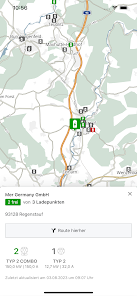
Für PKW-Parkplätzen, Haltestellen und Ladesäulen kann man nun genau einstellen, welche Untergruppen gezeigt werden sollen.


