

IcarusRPA
Contains ads

50K+
Downloads

Everyone
info


About this app
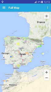
Interactive map where all the aerospace with restrictions to fly a RPAS (UAV) in Spain can be checked.
IcarusRPA is a map based tool that shows graphicly the flying restrictions involving RPAs in Spain. All performance data havce been adapted from the AIP (Aerocraft Information Pbls), which is the basic manual of aerocraft information basic for flying and operatin the RPAs (UAV).
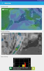
Important information afectting air operations (as Metar or Tafor of any airport -ICAO format-)can be consulted, including the notam of airpots and FIRs. The tool host different meothorologycal maps showing real-time data of windspeed, clouds and rain and the planetary K-index (Kp), used to measure the magnitude of geomagnetic storms.
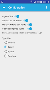
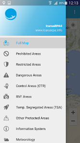
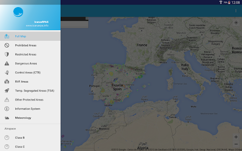
In this stage of the development of the application, the following information ois shown:
- Restricted areas,
- Hazardous areas,
- Forbidden areas,
- Control zoning (CTR),
- Fotographic flying restricted areas (ZRVF),
- Temporary Segregated areas (TSA),
- Other Protected areas,
- Aeropaces
GIS viewer
IcarusRPA is a map based tool that shows graphicly the flying restrictions involving RPAs in Spain. All performance data havce been adapted from the AIP (Aerocraft Information Pbls), which is the basic manual of aerocraft information basic for flying and operatin the RPAs (UAV).
Important information afectting air operations (as Metar or Tafor of any airport -ICAO format-)can be consulted, including the notam of airpots and FIRs. The tool host different meothorologycal maps showing real-time data of windspeed, clouds and rain and the planetary K-index (Kp), used to measure the magnitude of geomagnetic storms.
In this stage of the development of the application, the following information ois shown:
- Restricted areas,
- Hazardous areas,
- Forbidden areas,
- Control zoning (CTR),
- Fotographic flying restricted areas (ZRVF),
- Temporary Segregated areas (TSA),
- Other Protected areas,
- Aeropaces
GIS viewer
Updated on
Safety starts with understanding how developers collect and share your data. Data privacy and security practices may vary based on your use, region, and age. The developer provided this information and may update it over time.

No data shared with third parties
Learn more about how developers declare sharing

No data collected
Learn more about how developers declare collection
What's new
Updated CTR of Madrid