Plan de vuelo con drones
Contains ads
3.6star
7 reviews
1K+
Downloads

Everyone
info


About this app
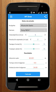
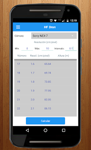
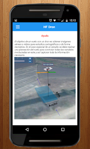
Calculates the parameters that determine a mission drone flight based on the flight altitude or resolution (pixel size) expected in the image.
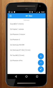
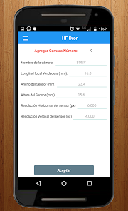
Adds, deletes or modifies features of cameras.
The parameters are:
-Time between images: This value indicates the time interval in which to acquire images to meet the problem data, knowing this value can program your camera drone to take pictures every so often. Commonly it speaks of seconds (2 s, 3 s, 4 s, etc).
• distance between images: You can program the camera to take pictures every so often or every certain distance, this value indicates the distance traveled the drone to acquire a picture of the surface.
• distance between flight lines (DLV): Usually the area to be covered by the flight is such an extension can not be covered once in the path of the drone, so it is necessary to make several passes or lines flight paths parallel to each other.
-width (A) and high (B) covering an image on the surface: These values indicate the width and length in meters covering a photo taken with a certain height drone. Based on these values, the area covering the image is obtained.
Updated on
Data safety
Developers can show information here about how their app collects and uses your data. Learn more about data safety

No information available
Ratings and reviews
3.6
7 reviews
What's new
Corrección de errores
App support
phone
Phone number
+527773053164


