
3.9star
141 reviews
10K+
Downloads

Everyone
info


About this app
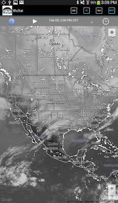
WxSat (short for Weather Satellite) displays and animates full-resolution, real-time weather satellite data. WxSat leverages SSEC Data Center holdings to provide global coverage for visible, infrared, and water vapor channels.
Several geostationary and polar orbiting weather satellites around the globe continuously capture observations of the earth. These data are acquired by the SSEC Data Center which has one of the most extensive collections of real-time and archived weather satellite data in the world. A server dedicated to WxSat blends the images into single hourly global composites for three different products (Visible, Infrared, and Water Vapor). The server stages the most complete hourly images (backfilled when necessary) every hour at 36 minutes past the hour. This allows for a majority of the satellite sources to be included in the composites. These hourly composites are staged for WxSat and form the basis of the animations.
The names of the different images in WxSat refer to the parts of the electromagnetic spectrum the satellite sensors are sampling. The atmosphere is transparent to different types of radiation in certain areas of the spectrum called channels. The three most widely used atmospheric channels are the visible (0.6 microns), infrared (10 to 12 microns), and water vapor (6.5 to 6.9 microns). Scientist combine information provided from all three types of images to forecast the weather, monitor forest fires, ice flows, ocean currents, and long term climate patterns from the unique global perspective that only satellites can provide.
Updated on
Safety starts with understanding how developers collect and share your data. Data privacy and security practices may vary based on your use, region, and age. The developer provided this information and may update it over time.

No data shared with third parties
Learn more about how developers declare sharing

No data collected
Learn more about how developers declare collection

Data is encrypted in transit
Ratings and reviews
3.8
124 reviews

Aubrey Urbanowicz
- Flag inappropriate
October 9, 2021
Not bad. Needs a few more features. First time I downloaded the state outlines never came on. Deleted and re installed and they're there. Would like to see color table options for IR and water vapor. Would be nice for a high res option on visible
2 people found this review helpful

Walter Clark
- Flag inappropriate
- Show review history
May 23, 2022
WxSat won't show features such as outlines of states or countries, it will only show state or province names, and clouds. WxSat may not have enough memory for showing borderlines (or outline of borders). Software for WxSat should be outdated so it could show borderlines of each state, province, or a country
2 people found this review helpful

Nate Moore (Rebootkid)
- Flag inappropriate
October 9, 2020
Does not do NOAA APT. This comes up when searching for a tool to decode noaa satellite feeds. This app does not perform that function, at all.
22 people found this review helpful
What's new
Restore satellite data access.