
4.5star
27 reviews
1K+
Downloads

Everyone
info

About this app
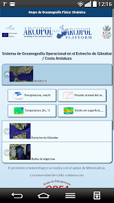
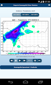
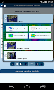
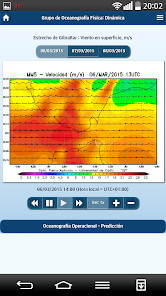
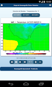
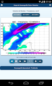
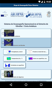
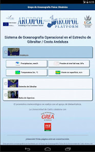
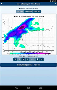
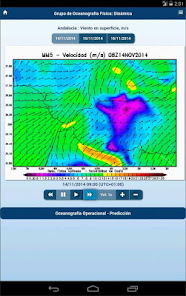
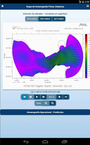
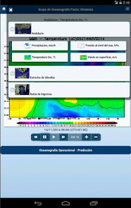
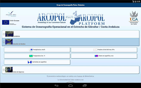
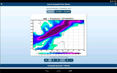
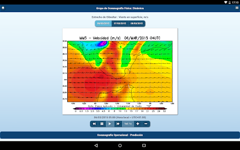
OceanUCA to visualize, through an intuitive and practical interface, maps of the entire Andalusian region with different resolutions to the Strait of Gibraltar and the Bay of Algeciras, corresponding to the hourly weather forecasts of temperature, precipitation and atmospheric pressure for Andalusia and oceanographic prediction of surface ocean currents in the Andalusian coast.
Predictions are made through the numerical results in real time and operatively generate oceanographic models developed by the Physical Oceanography Group Dynamics and meteorological models implemented in collaboration with Meteogalicia.
It has been developed within the framework of the European project ARCOPOLplatform.
Available web version (Android / iPhone / iPad): http://prediccion.uca.es/movil
Available data also from OceanUCA-Map: http://ocean1.uca.es/oceansmap
The University of Cadiz assumes no liability arising from the differences that may arise between the prediction provided and the existing actual values.
Updated on
Safety starts with understanding how developers collect and share your data. Data privacy and security practices may vary based on your use, region, and age. The developer provided this information and may update it over time.

No data shared with third parties
Learn more about how developers declare sharing

No data collected
Learn more about how developers declare collection
Ratings and reviews
4.5
27 reviews