Cartograph Map Viewer
In-app purchases
1K+
Downloads

Everyone
info
About this app
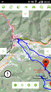
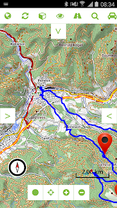
The Cartograph app views offline and online maps, supports track recording, editing, and live tracking. The app also supports the popular Mapsforge format, as well as SQLite based raster maps such as mbtiles and rmap (Locus).
Web: http://www.cartograph.eu
Help: http://www.cartograph.eu/help/
## Features
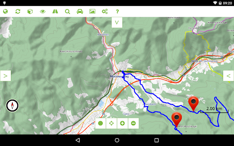
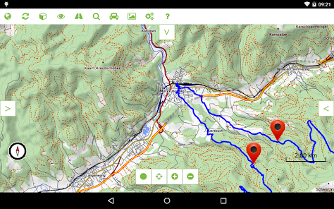
- View offline and online maps (slippy tiles and WMS/Web Map Services based on WG84/EPSG-4326/900913).
- Support for Mapsforge (0.6) offline vector maps and Mapsforge themes (V4, including customized style layering).
- MBTiles, and rmap (Locus) offline raster maps.
- GPS tracking (including USB-to-serial and Bluetooth-to-serial GPS mice).
- Support for Bluetooth 4 BLE heart frequency and cadence devices (for instance Polar H7 belt).
- Customizable trip computer.
- Support for 2nd map layer which can be used for overlay maps (e.g. OpenSeaMap), hillshading, etc.
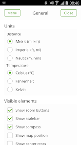
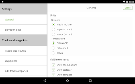
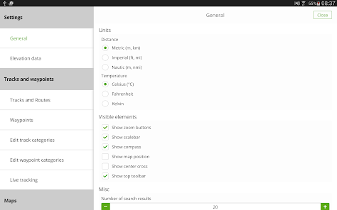
- Support for metric, imperial, and nautic units.
- Text-, photo-, and audio- waypoints.
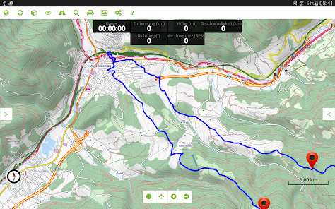
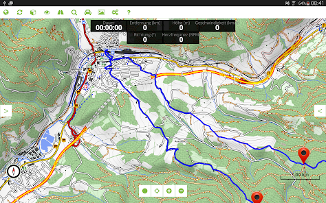
- Show multiple tracks at the same time.
- Simple chart, statistics, distance measurements.
## Pro features
- Online route and address search.
- Mapsforge multi-maps (combine multiple maps into a single one, e.g. around country borders).
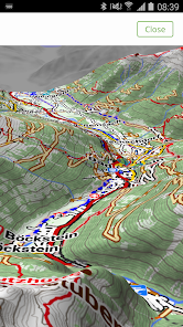
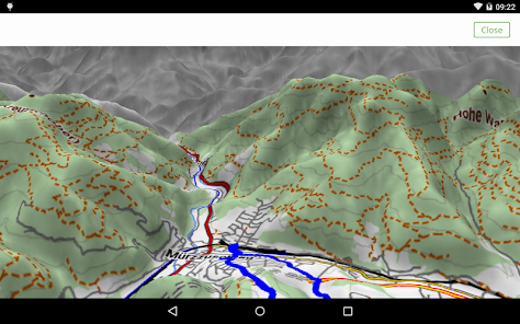
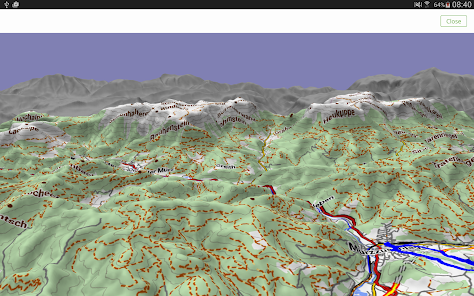
- A 3D view gives a 3D snapshot of the current location.
- Experimental (!) support for offline hill shading based on Nasa SRTM elevation data.
- Support for offline overlays (drinking water sources, restaurants, supermarkets, hostels, custom overlays).
- Basic track drawing and editing feature.
- Live tracking: send your current location to a custom webserver* via HTTP GET or GPSies service.
- Live polling: poll other users' location from a custom webserver* via HTTP GET and show it in the map.
*The webserver implementation is not part of the Cartograph app!
Web: http://www.cartograph.eu
Help: http://www.cartograph.eu/help/
## Features
- View offline and online maps (slippy tiles and WMS/Web Map Services based on WG84/EPSG-4326/900913).
- Support for Mapsforge (0.6) offline vector maps and Mapsforge themes (V4, including customized style layering).
- MBTiles, and rmap (Locus) offline raster maps.
- GPS tracking (including USB-to-serial and Bluetooth-to-serial GPS mice).
- Support for Bluetooth 4 BLE heart frequency and cadence devices (for instance Polar H7 belt).
- Customizable trip computer.
- Support for 2nd map layer which can be used for overlay maps (e.g. OpenSeaMap), hillshading, etc.
- Support for metric, imperial, and nautic units.
- Text-, photo-, and audio- waypoints.
- Show multiple tracks at the same time.
- Simple chart, statistics, distance measurements.
## Pro features
- Online route and address search.
- Mapsforge multi-maps (combine multiple maps into a single one, e.g. around country borders).
- A 3D view gives a 3D snapshot of the current location.
- Experimental (!) support for offline hill shading based on Nasa SRTM elevation data.
- Support for offline overlays (drinking water sources, restaurants, supermarkets, hostels, custom overlays).
- Basic track drawing and editing feature.
- Live tracking: send your current location to a custom webserver* via HTTP GET or GPSies service.
- Live polling: poll other users' location from a custom webserver* via HTTP GET and show it in the map.
*The webserver implementation is not part of the Cartograph app!
Updated on
Data safety
Developers can show information here about how their app collects and uses your data. Learn more about data safety

No information available
What's new
- Added support for Mapsforge 0.6.1 and new Mapsforge V5 render themes.
- Added night map mode (in settings).
- Added basic support for importing Groundspeak geocaching GPX files.
- Added measure distance button to the top toolbar.
- Added option to change the selected/recording track color.
- Added option to fade out menus and top toolbar.
- Added option to disable automatic "keep screen on" function.
- Fixed Mapsforge multi-maps.
- Map popup is now disabled by default.


