InfoNappe
10K+
Downloads

Everyone
info

About this app
InfoNappe provides access from a mobile to data on water levels in aquifers, data accessible on the Access Portal to Data on Underground Waters (ADES, http://ades.eaufrance.fr) which gathers water level and groundwater quality data, Water Information System portal, in France (http://eaufrance.fr).
Questions about the application can be submitted via the BRGM assistance site (https://assistance.brgm.fr/formulaire/posez-votre-question?tools=InfoNappe).
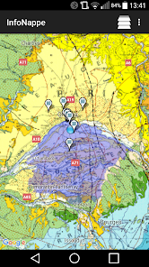
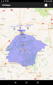
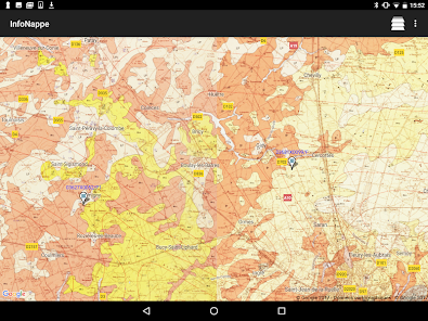
InfoNappe displays in a list or a map the water level measurement stations located nearby, with a predefined search radius, or on a predetermined area.
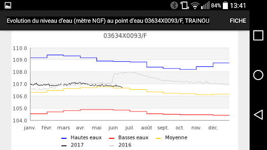
It is then possible to access the graph showing the evolution of this water level associated with statistical data (highest and lowest water levels).
These data are accessible for each water level measurement station, referenced in the ADES database.
Associated with this evolution of the water level, we can also obtain the sheet for this water point on the ADES website.
Questions about the application can be submitted via the BRGM assistance site (https://assistance.brgm.fr/formulaire/posez-votre-question?tools=InfoNappe).
InfoNappe displays in a list or a map the water level measurement stations located nearby, with a predefined search radius, or on a predetermined area.
It is then possible to access the graph showing the evolution of this water level associated with statistical data (highest and lowest water levels).
These data are accessible for each water level measurement station, referenced in the ADES database.
Associated with this evolution of the water level, we can also obtain the sheet for this water point on the ADES website.
Updated on
Safety starts with understanding how developers collect and share your data. Data privacy and security practices may vary based on your use, region, and age. The developer provided this information and may update it over time.


What's new
Corrections et améliorations diverses.