
Shelters in Fukui City
100+
Downloads

Everyone
info
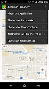

About this app
This application shows the shelters in Fukui city for earthquakes or floods based on the public data provided at Fukui City Open Data Park.
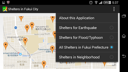
Red markers indicate shelters for first choice. Yellow markers indicate shelters which will be opened according to the scale of disasters.
Navigation to the shelter will be invoked by tapping the marker.
Common open data of a shelter list of Fukui prefecture and 17 municipalities becomes available with downloading, and can be displayed on map. Color of markers also is varying according to the type of shelters.
Even in a state that can not be connected to the server, such as the case of a disaster, it is possible to display a marker on the map by obtaining the data from the cache. The cache will keep valid data for one year.
It becomes possible to search shelters in neighborhood from the data provided by
open data platform (data source ).
Fukui City Open Data Park and Fukui Prefecture Open Data Library basically provide public data based on Creative Common Attribute 2.1 Japan license.
Open data platform provides data based on Creative Commons license "CC BY".
Updated on
Safety starts with understanding how developers collect and share your data. Data privacy and security practices may vary based on your use, region, and age. The developer provided this information and may update it over time.

No data shared with third parties
Learn more about how developers declare sharing

No data collected
Learn more about how developers declare collection
What's new
New application bundle are released for API 33. This release correspondents format change of Fukui City Open Data.