ダムナビ 日本全国ダム要覧
Contains ads
3.6star
35 reviews
10K+
Downloads

Everyone
info
About this app
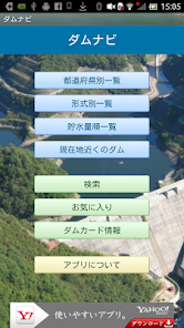
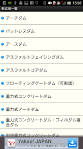
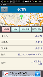
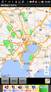
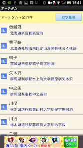
Let's go see the dam! "DamNavi" is an application that covers data such as water system, river name, type, purpose, size, total water storage volume, operator, completion year, etc. for approximately 3000 dams throughout Japan. In addition to sorting functions such as by prefecture, type, and water storage volume, the location information of all dams is recorded and can be displayed on a map. It also has a function to search and display dams near your current location. It is also linked with a route navigation function that supports driving trips and touring trips, so you can easily visit and tour the dam. In addition, it contains information on the distribution of the topical Ministry of Land, Infrastructure, Transport and Tourism "Dum Card". * Dam card information is based on the data of the Ministry of Land, Infrastructure, Transport and Tourism as of October 1, 2016.
You can send the location to the car navigation system using Denso's NaviCon app.
You can send the location to the car navigation system using Denso's NaviCon app.
Updated on
Safety starts with understanding how developers collect and share your data. Data privacy and security practices may vary based on your use, region, and age. The developer provided this information and may update it over time.

This app may share these data types with third parties
Device or other IDs

No data collected
Learn more about how developers declare collection

Data is encrypted in transit

Data can’t be deleted
Ratings and reviews
3.6
35 reviews
What's new
バグフィックスを行いました。


