4.2star
98 reviews
10K+
Downloads

Everyone
info

About this app
From 01.01.2024, the new name of the Earth Information System (ŽIS) is the Earth Resources Monitoring Information System (ŽISIS).
The task of ŽISIS is to use information technologies to create spatial data sets (hereinafter - Spatial data sets about land) and maps, which would collect and display information about areas of abandoned land, areas of drained land, the condition of drained land areas, the layout of soils, their physical and agrochemical properties and other characteristics affecting land use.
The purpose of ŽISIS is to systematically monitor, analyze and forecast the state of the country's land resource use, identify changes due to anthropogenic impact, justify rational land use and environmental improvement measures, and provide statistical information to users.
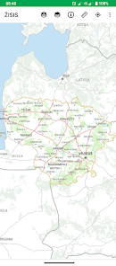
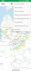
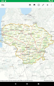
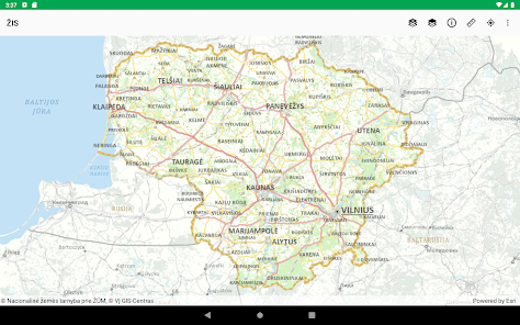
Using the ŽISIS app, users can view and use ŽISIS and other spatial data sets on their mobile device. If you have comments, suggestions, please contact us by e-mail. by mail zisis@zudc.lt
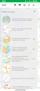
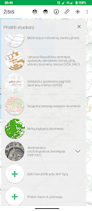
ŽISIS data consists of state thematic spatial data sets and other thematic spatial data sets, which collect information on characteristics affecting land use. State thematic spatial data sets:
- M 1:10000 soil spatial data set of the territory of the Republic of Lithuania (Dirv_DR10LT);
- M 1:10000 dataset of agrochemical soil properties of the territory of the Republic of Lithuania (DirvAgroch_DR10LT);
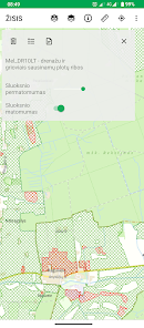
- M 1:10000 set of land reclamation condition and waterlogging spatial data of the territory of the Republic of Lithuania (Mel_DR10LT);
- Spatial data set of abandoned lands of the territory of the Republic of Lithuania (AŽ_DRLT).
Copyright of spatial data sets and maps: https://zisis.lt/programeles/autoriu-teises/
More information about ŽISIS: https:/zisis.lt/
The task of ŽISIS is to use information technologies to create spatial data sets (hereinafter - Spatial data sets about land) and maps, which would collect and display information about areas of abandoned land, areas of drained land, the condition of drained land areas, the layout of soils, their physical and agrochemical properties and other characteristics affecting land use.
The purpose of ŽISIS is to systematically monitor, analyze and forecast the state of the country's land resource use, identify changes due to anthropogenic impact, justify rational land use and environmental improvement measures, and provide statistical information to users.
Using the ŽISIS app, users can view and use ŽISIS and other spatial data sets on their mobile device. If you have comments, suggestions, please contact us by e-mail. by mail zisis@zudc.lt
ŽISIS data consists of state thematic spatial data sets and other thematic spatial data sets, which collect information on characteristics affecting land use. State thematic spatial data sets:
- M 1:10000 soil spatial data set of the territory of the Republic of Lithuania (Dirv_DR10LT);
- M 1:10000 dataset of agrochemical soil properties of the territory of the Republic of Lithuania (DirvAgroch_DR10LT);
- M 1:10000 set of land reclamation condition and waterlogging spatial data of the territory of the Republic of Lithuania (Mel_DR10LT);
- Spatial data set of abandoned lands of the territory of the Republic of Lithuania (AŽ_DRLT).
Copyright of spatial data sets and maps: https://zisis.lt/programeles/autoriu-teises/
More information about ŽISIS: https:/zisis.lt/
Updated on
Safety starts with understanding how developers collect and share your data. Data privacy and security practices may vary based on your use, region, and age. The developer provided this information and may update it over time.

No data shared with third parties
Learn more about how developers declare sharing

No data collected
Learn more about how developers declare collection
Ratings and reviews
4.2
98 reviews

A Google user
- Flag inappropriate
February 12, 2017
Butu labai gerai jai dar įkeltumėte regios ir miškų kadastro duomenys
10 people found this review helpful
A Google user
- Flag inappropriate
January 25, 2017
Oho, kiek detalios informacijos čia jie turi.
4 people found this review helpful
A Google user
- Flag inappropriate
April 23, 2016
Puikiai
3 people found this review helpful
What's new
Versija 3.8.0:
- pakeistas programėlės pavadinimas į ŽISIS (Žemės išteklių stebėsenos informacinė sistema);
- kiti smulkūs patobulinimai ir klaidų pataisymai.
- pakeistas programėlės pavadinimas į ŽISIS (Žemės išteklių stebėsenos informacinė sistema);
- kiti smulkūs patobulinimai ir klaidų pataisymai.