
OpenMapKit
5K+
Downloads

Everyone
info

About this app
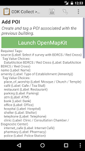
OpenMapKit (OMK) is an extension of OpenDataKit allowing users to create professional quality mobile data collection surveys for field data collection.
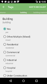
OpenMapKit launches directly from OpenDataKit when the OSM question type is enabled in a standard survey. Simply include OSM questions and tags in your survey to collect information on OSM in the field.
Traditional field data collection tools for OpenStreetMap have either relied on paper or are too complicated, targeted at GIS professionals, or lack an understanding of traditional survey techniques. As new projects such as Missing Maps and other humanitarian field data collection projects focus on field data collection the need for a structured, yet simple, OpenStreetMap field data collection tool became apparent. OpenMapKit serves this need.
Main features include the ability to:
- author surveys using xlsforms and OpenDataKit
- edit existing OSM data
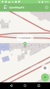
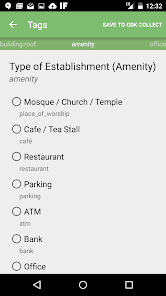
- create new OSM POI features
- survey constraints
OpenMapKit launches directly from OpenDataKit when the OSM question type is enabled in a standard survey. Simply include OSM questions and tags in your survey to collect information on OSM in the field.
Traditional field data collection tools for OpenStreetMap have either relied on paper or are too complicated, targeted at GIS professionals, or lack an understanding of traditional survey techniques. As new projects such as Missing Maps and other humanitarian field data collection projects focus on field data collection the need for a structured, yet simple, OpenStreetMap field data collection tool became apparent. OpenMapKit serves this need.
Main features include the ability to:
- author surveys using xlsforms and OpenDataKit
- edit existing OSM data
- create new OSM POI features
- survey constraints
Updated on
Data safety
Developers can show information here about how their app collects and uses your data. Learn more about data safety

No information available
What's new
This release includes one bug fix and one new feature.
Feature : Copy constraints.json from ODK Media Directory
Jason Rogena added code that copies any omk-constraints.json file from a ODK Media directory to the constraints directory. This allows ODK the ability to provide constraints for a given form automatically.
Bug Fix: Select One Tag Value Dialog Does not Crash with POIs
A bug observed at the UC Davis Center for Spatial Sciences. Select one tag dialog was crashing when adding POIs.