PannonRIS
1K+
Downloads

Everyone
info


About this app
River Information Services (RIS) means the harmonised information services to support traffic and transport management in inland navigation, including, wherever technically feasible, interfaces with other transport modes.
The PannonRIS system is permanently developed and operated in the framework of the co-operation between the Ministry of National Development, the National Transport Authority and the National Association of Radio Distress-Signalling and Infocommunications (RSOE).
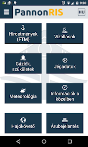
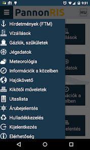
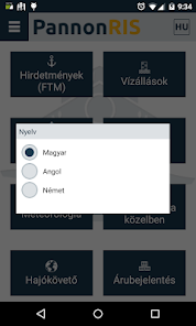
The PannonRIS mobile application offers the following continuously updated information for the stakeholders of inland navigation on the Hungarian section of the River Danube free of charge:
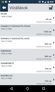
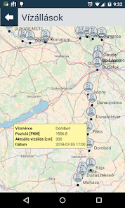
• water level information,
• notices to skippers,
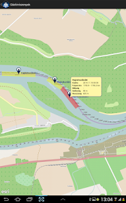
• shallow section information,
• ice information.
The application is developed by RSOE, provider of the Hungarian River Information Services (PannonRIS).
www.pannonris.hu www.rsoe.hu
The PannonRIS system is permanently developed and operated in the framework of the co-operation between the Ministry of National Development, the National Transport Authority and the National Association of Radio Distress-Signalling and Infocommunications (RSOE).
The PannonRIS mobile application offers the following continuously updated information for the stakeholders of inland navigation on the Hungarian section of the River Danube free of charge:
• water level information,
• notices to skippers,
• shallow section information,
• ice information.
The application is developed by RSOE, provider of the Hungarian River Information Services (PannonRIS).
www.pannonris.hu www.rsoe.hu
Updated on
Safety starts with understanding how developers collect and share your data. Data privacy and security practices may vary based on your use, region, and age. The developer provided this information and may update it over time.

No data shared with third parties
Learn more about how developers declare sharing

No data collected
Learn more about how developers declare collection
What's new
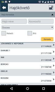
Installation of a ship tracker
App support
phone
Phone number
+3614694164


