
Naturkartan
100K+
Downloads

Everyone
info
About this app
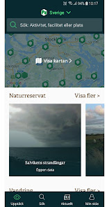
The nature map - your guide to Sweden's nature and outdoor life.
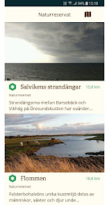
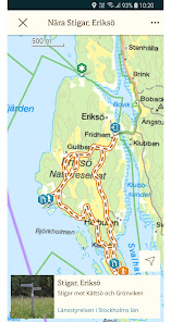
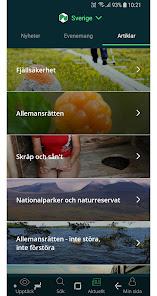
Sweden's most comprehensive nature guide with lots of nature experiences. From nature reserves, and hiking trails to bathing areas and bird towers - presented on the Terrain Map and Mountain Map from the National Land Survey.
The app contains information from the municipalities of Arboga, Borlänge, Botkyrka, Danderyd, Ekerö, Falun, Halmstad, Haninge, Helsingborg, Huddinge, Hylte, Järfälla, Jönköping, Katrineholm, Kinda, Kungsbacka, Kungsör, Köping, Laholm, Leksand, Lidingö, Linköping, Mora , Motala, Mörbylånga, Nacka, Norrköping, Rättvik, Skinnskatteberg, Smedjebacken, Sollentuna, Stockholm, Söderköping, Tranås, Trosa, Tyresö, Täby, Upplands Väsby, Vallentuna, Varberg, Vaxholm, Vingåker, Värmdö, Värnamo, Växjö, Ölmh, Älmh Östersund, Österåker.
From the organizations Ark56, Bergslagsleden, Bruksleden, Hemavan / Tärnaby, Hälsans stig, Romboleden, S: t Olavsleden, Stockholms Pilgrimscenter i Tyresö, Tyresta Nationalpark, Upplandsstiftelsen.
And from the county administrative boards in Norrbotten County, Västerbotten County, Jämtland County, Uppsala County, Västmanland County, Stockholm County and Halland County.
Do you lack content? Contact your municipality or county administrative board and ask them to join.
Updated on
Safety starts with understanding how developers collect and share your data. Data privacy and security practices may vary based on your use, region, and age. The developer provided this information and may update it over time.

No data shared with third parties
Learn more about how developers declare sharing

This app may collect these data types
Location, Personal info and 3 others

Data is encrypted in transit

Data can’t be deleted
What's new
1.0b234
- Felkorrigeringar och prestandaförbättringar
- Felkorrigeringar och prestandaförbättringar


